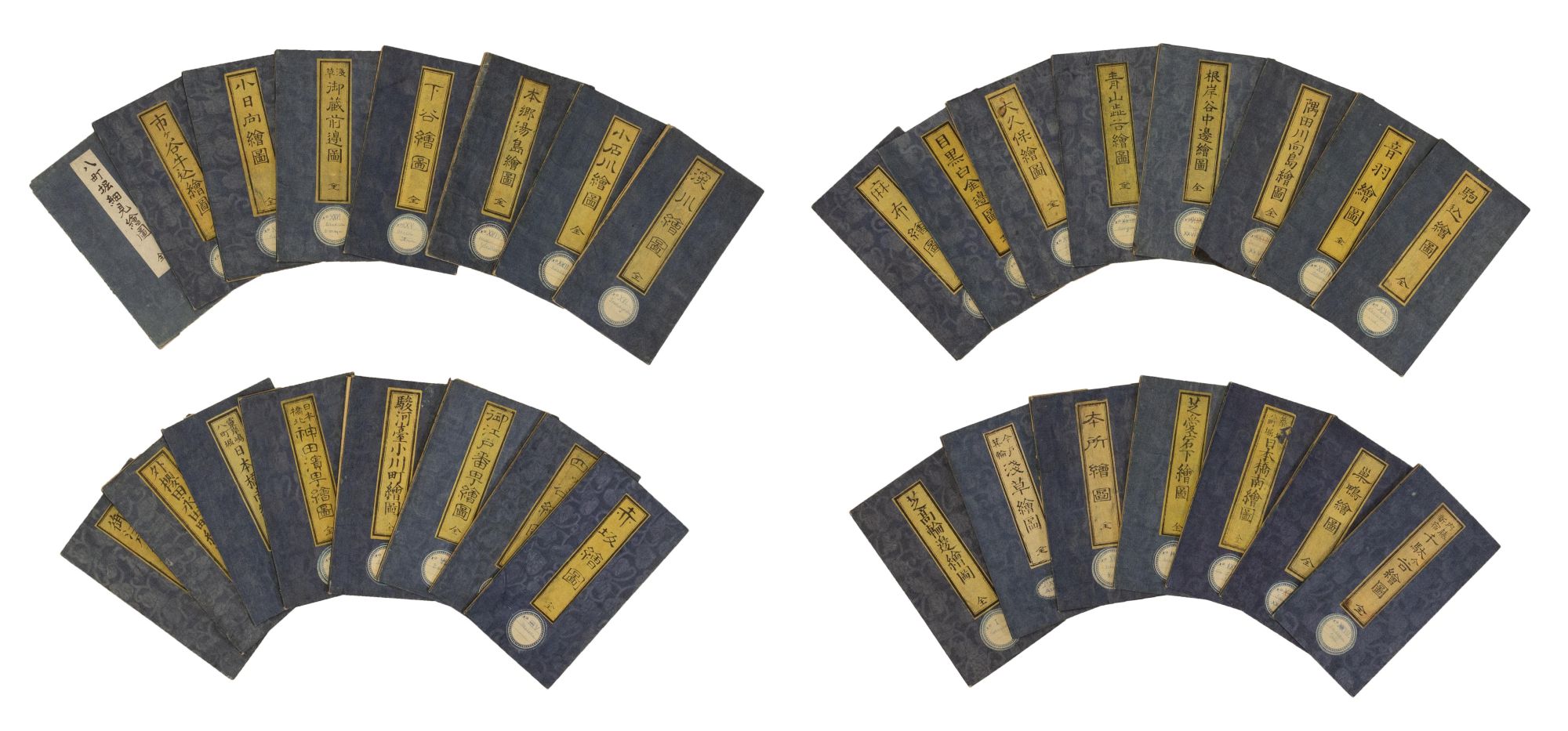
Edo Kiriezu. Set of 31 maps of Tokyo.
WITH AN UNRECORDED 31st MAP
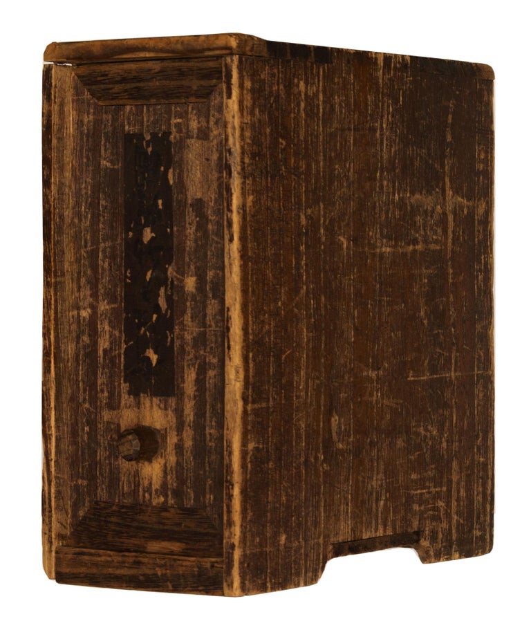
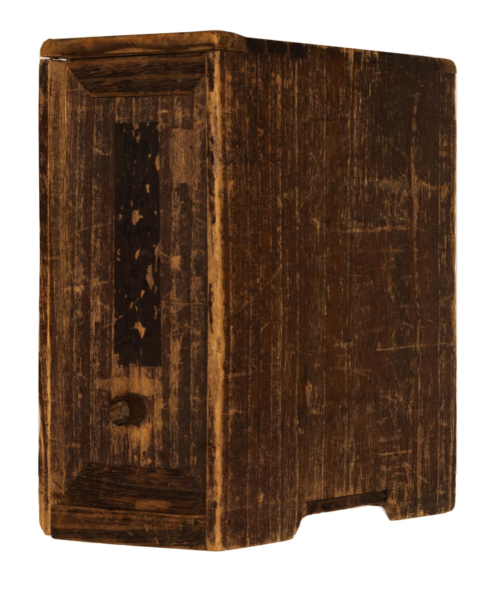
TOMATSU Masanori, Muneyasu KAGEYAMA et al. Edo Kiriezu. A complete set of 31 Coloured Woodblock Maps of Tokyo. 12mo, 165 x 90 mm. folded, 490 x 535 mm. unfolded, each bound in original pale blue wrappers, preserved in a contemporary wooden box. Edo: Owariya Seishichi, 1852-1864.
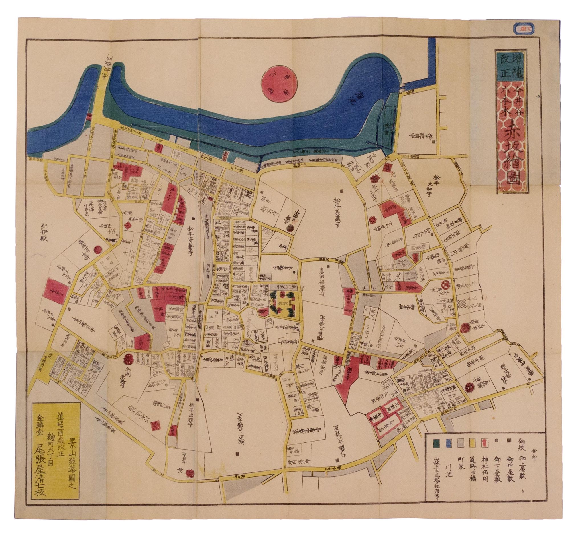
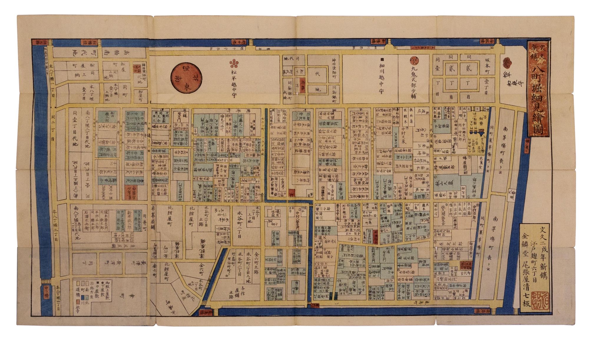
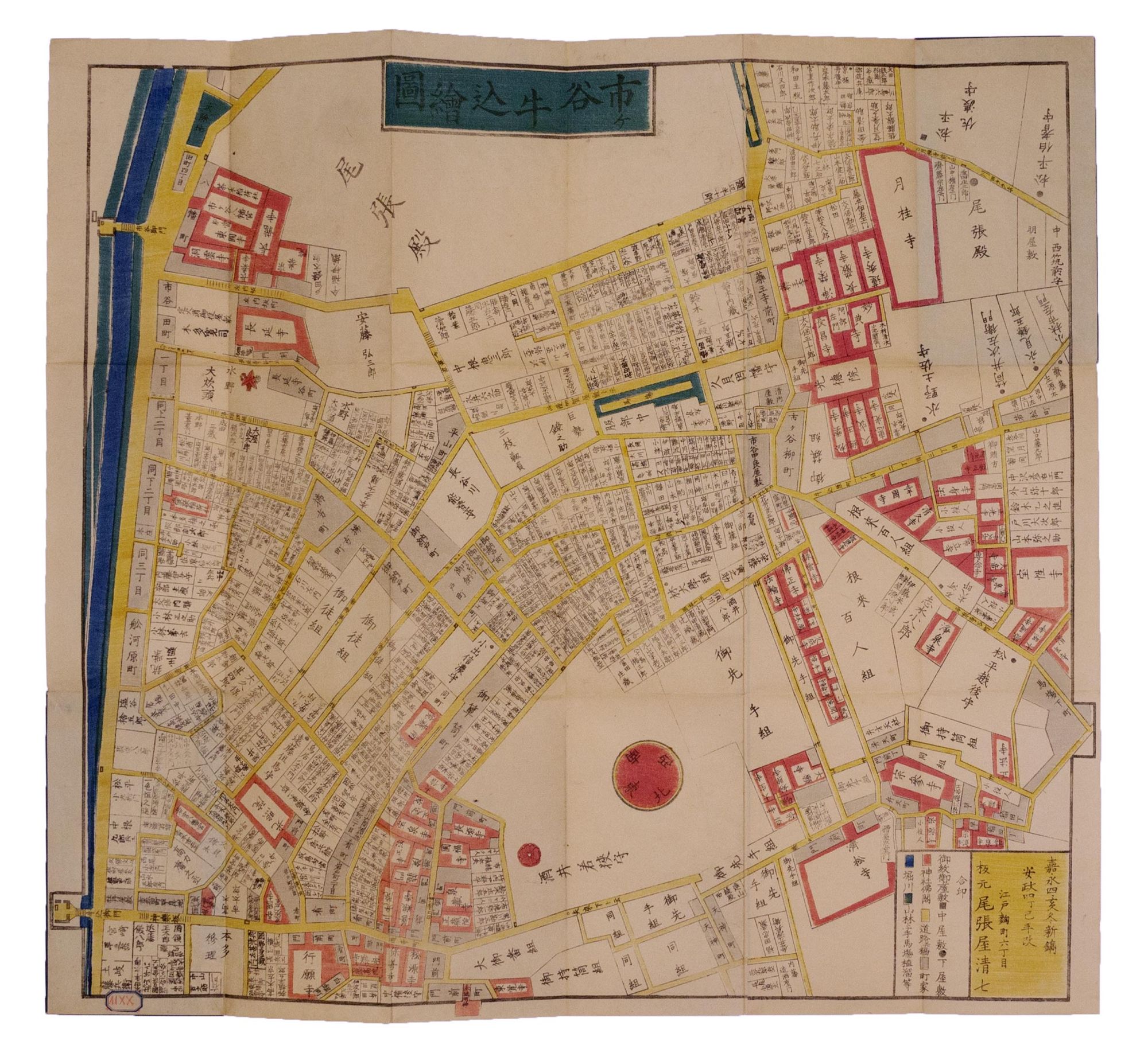
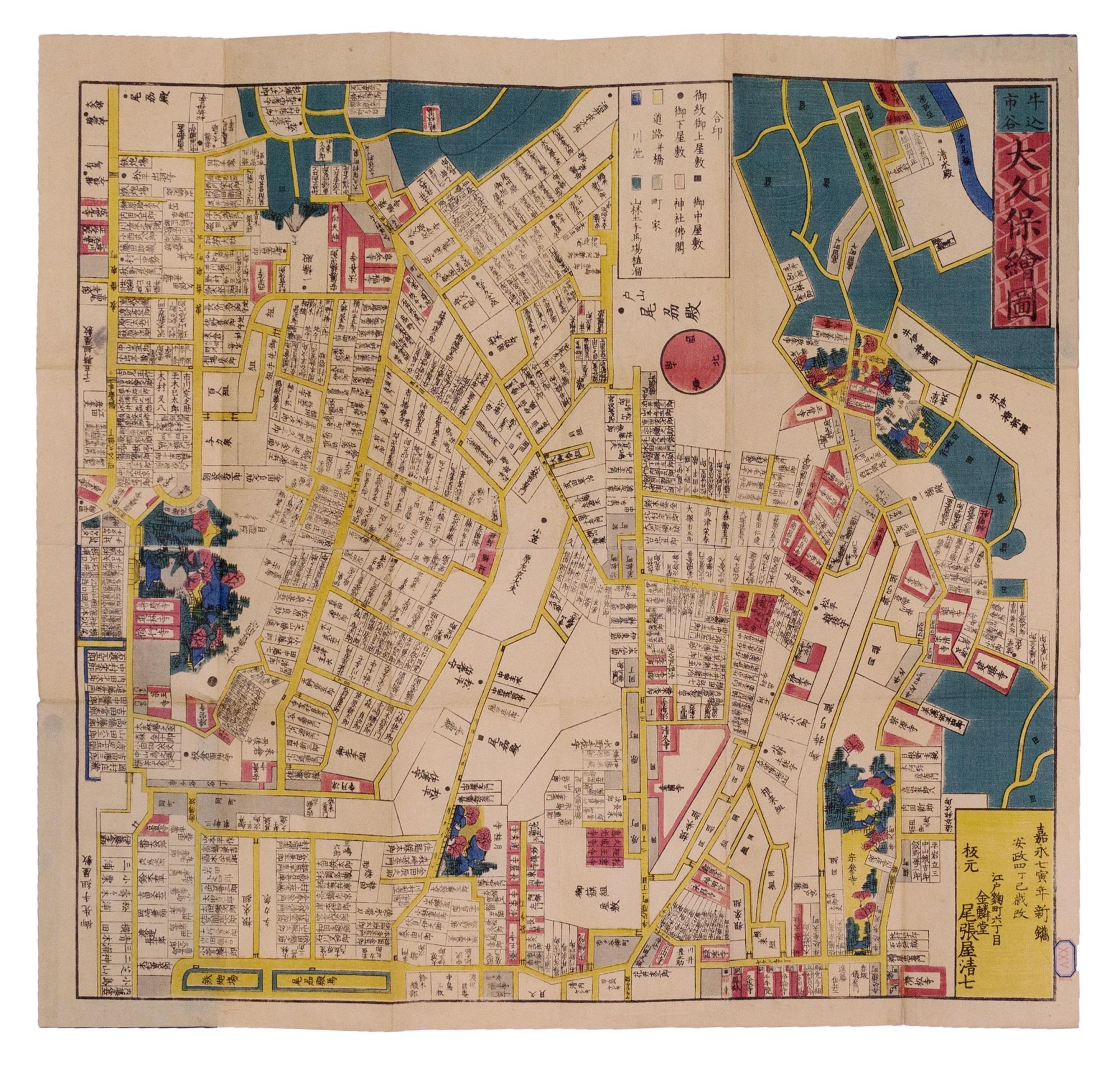
A very special set of these Tokyo maps consisting of a mix of the first and revised editions, but containing an unrecorded 31st part. This part covered the Hacchobori district which was composed of the security administration; police, judge, defense, sheriff, etc. This colourful series of late Edo period maps depicts Tokyo's wards and the buildings, temples, shrines, gardens and residences therein. These maps represent not only a fine example of woodblock printing, but also remain an indispensable source of information on the architecture of Tokugawa Edo.
Each map includes a legend delineating geographical and architectural elements by colour and shape: roads and bridges (yellow), rivers, lakes and ocean (blue), shrines and temples (red), fields and hills (green), and merchant houses or machiya (grey). Lesser noble residences are indicated by a black circle, higher ranking residences with a black square. Residences of even higher distinction are marked with the families' mon, or crest. Remarkably, nearly all residences also include the name of the inhabitant's family.
The most important structures are illustrated with rough, yet charming depictions of the actual buildings, often surrounded by images of trees and gardens. Some of these structures include: The Hie Shrine (lost to bombing in the Second World War); Kanei-ji Temple, burial sight of 6 Tokagawa Shoguns; Senso-ji Temple, the oldest temple in Tokyo; Hamagoten Garden, the villa of the Tokugawa family, and many others.
We can identify three creators of the maps: Muneyasu Kageyama, Masanori Tamatsu, and Yoshitomo Iyama. Each map was first published by Owariya, Seishichi, between 1849-1855, and some were subsequently reprinted. It has been generally considered that the entire series consisted of 30 maps as identified in Kerlen as well as a set digitized by the University of British Columbia, however most institutional holdings list only the odd map, thus complete runs of the series are extremely rare, and our 31st map in unrecorded. Our group remains in remarkably fine, bright condition and in a contemporary box. A complete list of each map's creator, title, size and publication date, is available upon request.
Kerlen, Catalogue of Pre-Meiji Japanese Books and Maps in Public Collections in the Netherlands 221 (citing 30 maps).
Item nr. 171513
Price:
$25,000.00